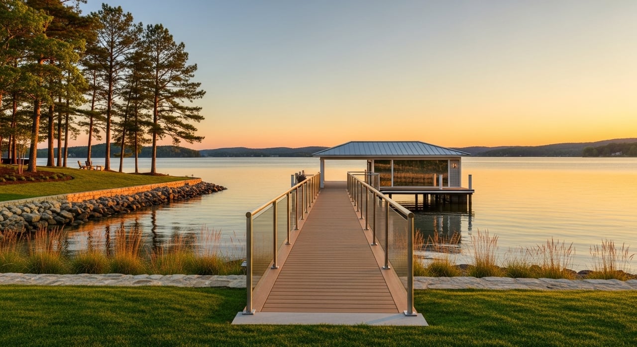
If you own or are buying on the North Shore of Smith Mountain Lake, dock design is not just about looks. What you build touches safety, shoreline health, neighbor relations, and resale value. The good news: with a clear plan and the right approvals, you can create a dock that works beautifully and complies with the rules that protect the lake we all enjoy.
Why Dock Rules Matter for Lakefront Owners
Compliance rules exist to keep navigation clear, protect habitat, and ensure fair use of coves. On Smith Mountain Lake, most shoreline work falls under the Smith Mountain Project’s Shoreline Management Plan, administered by Appalachian Power. That plan guides what you can build within the project boundary up to the 800-foot contour, with the lake’s normal pool around 795 feet according to the Shoreline FAQs.
A compliant dock protects your investment too. Buyers ask about permits and status. Lenders and insurers often do as well. If a structure violates setbacks or footprint limits, you could face redesigns, delays, or removal orders. Planning correctly at the start prevents those headaches.
Learn the Rules Before You Sketch
Authorities and approvals to expect
At Smith Mountain Lake, several layers can apply:
- Appalachian Power Shoreline Management Plan: primary authority for docks and shoreline activity within the project boundary; they issue occupancy and use permits and coordinate inspections per the SMP overview.
- Federal Energy Regulatory Commission: approves and enforces the SMP as part of the hydropower license as described by the project FAQs.
- State of Virginia: submerged lands and pier rules in the Code of Virginia inform design and review factors statewide see Title 28.2 provisions.
- U.S. Army Corps of Engineers: dredging or fill work may need federal authorization and state water quality certification USACE permitting info.
- County approvals: Franklin County can require building and zoning permits for dock structures; confirm local requirements early Franklin County zoning ordinance.
Key takeaway: start with Appalachian Power’s SMP and expect to coordinate county and sometimes federal or state reviews depending on your scope.
Common limits to plan around
While every lot is unique, several constraints show up often:
- Project boundary and elevation references: SMP jurisdiction extends to the 800-foot contour, while many practical measurements refer to 795 feet normal pool. Use the correct reference when measuring shoreline length and depth per the SMP FAQs.
- Footprint and frontage: Local practitioner summaries often describe maximum dock footprints tied to shoreline length. For example, many guides note footprints around 1,500 square feet for roughly 100 to 300 feet of shoreline, and up to 3,000 square feet for more than 300 feet. Treat these as common rules of thumb and verify against your property’s classification and the current SMP before relying on them see a widely cited local guide summary.
- Setbacks and cove share: Placement typically respects setbacks from extended property lines and separation from nearby docks. The SMP also applies a one-third-of-the-cove methodology to protect navigation corridors. Your dock cannot extend so far that it blocks fair passage or neighbor access SMP shoreline resources.
- Access path width and materials: Access paths within the project boundary are commonly limited in width and should use permeable materials, with accessibility exceptions noted in SMP guidance SMP FAQs.
- Enclosures and plumbing: Enclosed, habitable space on docks is generally not allowed, and sanitary fixtures that discharge to the lake are restricted. Existing legacy fixtures may be grandfathered but expansions are limited SMP FAQs.
HOA and neighborhood overlays
Many North Shore communities have HOA rules that add aesthetic or placement standards. HOA approval does not replace SMP or county permits, so plan to meet both sets of requirements.
Choose a Design That Fits the Rules
Dock footprints and slip configurations
Start with how you use the lake. Do you need a single boat slip, a PWC port, or a layout for multiple watercraft? In coves, the one-third rule and setbacks often drive overall dimensions and orientation SMP shoreline resources. On open water, wind exposure can affect where you place slips and how you orient the roof to reduce uplift.
If your shoreline frontage is modest, a compact L or U configuration can add useful tie-up space without overreaching into the cove. If you have longer frontage, you may have more footprint flexibility, subject to the SMP classification. Always verify footprint allowances for your lot before you finalize a design see common local footprint summaries.
Roofs, lifts, and utilities
Open-roofed boathouses and boat lifts are common, but closed walls and habitable rooms are typically restricted. Electrical service at the dock must meet code and be installed by qualified professionals due to the risk of stray voltage. Local lake groups emphasize dock electrical safety and visibility; reflectors on outer edges improve nighttime navigation SML Association safety notes. Follow SMP guidance on allowable features and required reflectors for post-2003 permits SMP FAQs.
Plumbing on docks is tightly controlled. Smith Mountain Lake is a no-discharge zone for vessel sewage, which shapes what is permissible for sanitation on or near docks Virginia regulation reference.
Materials and shoreline protection
Design for durability and water quality. Per SMP guidance, prioritize vegetative buffers and bioengineering for shoreline stabilization. Hard armoring like bulkheads is discouraged and may require extra review. Access paths should be permeable, and vegetation removal within the project boundary often needs a vegetation permit with mitigation planting lists provided in SMP resources SMP FAQs.
If siltation affects access, maintenance dredging might be possible, but only under strict conditions. Dredging is limited to accumulated sediment, is restricted during the fish spawning window, and larger volumes trigger USACE permitting and state water quality review SMP FAQs and USACE guidance.
Navigate Permits and Inspections
What to prepare: surveys and drawings
You will likely need:
- A licensed shoreline survey showing extended property lines to the correct contour and existing structures. This ensures setbacks and cove calculations are accurate Status of Property guidance.
- Scaled plan drawings with dimensions, slip locations, roof outlines, access path widths, distances to neighbors, and water depth notations SMP shoreline resources.
- If dredging is included, sediment volume estimates and a schedule outside the typical February 15 to June 15 spawning window, plus USACE coordination as needed SMP FAQs.
Typical steps and timelines
A simple sequence to keep you on track:
- Site walk and concept sketch with a qualified dock builder.
- Order a licensed survey and request a Status of Property Report from Appalachian Power to confirm shoreline classification and any existing conditions or violations Status of Property overview.
- Finalize design drawings and submit your SMP occupancy and use permit application SMP portal.
- Apply for Franklin County building/zoning permits as required county zoning ordinance.
- If dredging or fill is proposed, coordinate with USACE and DEQ for federal and state approvals USACE permitting.
Processing time varies with scope and season. Local practitioners often cite several weeks to a few months from complete submission to approval, longer if multiple agencies are involved. Build those windows into your project plan see a regional summary of typical timelines.
After-approval compliance and inspections
Keep approved plans on site. Build to the permitted dimensions and materials. Expect inspections by Appalachian Power and county officials. If you change the design midstream, get written approval before proceeding. After completion, confirm final sign-offs and keep your permit file. This documentation matters for future sales and insurance.
Factor In Site Conditions and Neighbors
Water depth, slope, and wave exposure
Smith Mountain Lake levels fluctuate due to hydropower operations. Design pile lengths and slip depths for low-water access and safe mooring. Review historical levels and consider fish habitat recommendations where you place structures or habitat features habitat guidance.
Wind and boat wake exposure can influence roof orientation, bracing, and bumper placement. In narrow coves, turn radii and fairway width become critical.
Property lines, views, and navigation clearance
Use your survey to extend side lot lines into the water. Respect required setbacks and maintain adequate clearance from neighboring docks. The SMP’s one-third cove methodology helps preserve navigation lanes through shared spaces SMP shoreline resources.
Being a good neighbor helps. Share your preliminary plan, confirm sightlines, and coordinate construction access when possible.
Construction windows and lake levels
Try to schedule in-water work outside the typical February 15 to June 15 spawning season if dredging is included SMP FAQs. Plan staging and material delivery when lake levels and weather support safe, efficient work.
Budget, Builder, and Project Management
Cost drivers and allowances
Your budget will be shaped by footprint size, roof type, lift count, electrical scope, shoreline work, and dredging. Surveys, permit fees, and engineering add soft costs. If your lot requires a longer access walkway or more robust framing due to exposure, plan for those materials up front.
Vetting dock builders and engineers
Choose pros with recent SMP permit experience on the North Shore. Ask for references, sample plan sets, and typical timelines. Confirm they design to the correct elevation references and understand setbacks and cove-share limits SMP FAQs. For projects with dredging or wetlands, make sure your team can coordinate with USACE as needed USACE permitting.
Avoiding delays and change orders
- Lock your footprint and slip layout after survey and Status of Property review.
- Submit complete applications with clear dimensions, depth notes, and neighbor distances.
- Track review windows and respond to request-for-information quickly.
- Do not build ahead of permits. Changes after approval should be documented and reapproved.
Buying or Selling With a Dock
Due diligence on permits and compliance
If you are under contract on a lake home, order a Status of Property Report to see what is permitted, what exists, and whether any compliance issues are outstanding Status of Property. Confirm county permit history too Franklin County zoning. Unresolved violations can delay closing or limit financing.
Evaluating existing structures and upgrades
Measure the current dock against the survey and permitted plans. Check electrical safety and visible reflectors. Ask about any prior dredging and timing to comply with spawning restrictions SMP FAQs. If you plan to enlarge or reconfigure, verify footprint capacity and setbacks before budgeting.
Insurance and financing considerations
Insurers may request evidence of permitted construction and electrical compliance. Lenders can ask for permit documentation, especially on newer structures. Keeping a clean, well-organized permit file can smooth underwriting and protect value.
Plan Your Dock With Confidence
A well-designed, well-permitted dock lets you enjoy the lake without surprises. Start with the SMP rules, verify your site with a survey and Status of Property Report, and align your design with shoreline protections and navigation needs. If you would like a step-by-step planning call, vetted builder introductions, or help reviewing permits before you buy or sell, reach out to Lisa Santacaterina. We are happy to help you move forward with clarity and confidence.
FAQs
Who decides what I can build on my shoreline?
- Appalachian Power’s Shoreline Management Plan governs docks within the project boundary, with FERC oversight. County permits and, for dredging, USACE approvals may also apply SMP FAQs and USACE permitting.
How big can my dock be on the North Shore?
- Many local summaries cite footprint ranges tied to shoreline length, such as about 1,500 square feet for roughly 100 to 300 feet of frontage and up to 3,000 square feet for more than 300 feet. Treat these as guidelines and verify your exact allowance with the current SMP and AEP Shoreline Management example summary.
Do I need a survey before applying?
- Yes. A licensed shoreline survey and a Status of Property Report help confirm setbacks, cove calculations, and existing conditions before you submit plans Status of Property.
Can I dredge to deepen my slip?
- Possibly. Dredging is limited to accumulated sediment, restricted during the typical February 15 to June 15 spawning window, and may require USACE authorization depending on volume SMP FAQs and USACE info.
Are enclosed boathouses or bathrooms allowed?
- Enclosed, habitable space is generally not permitted, and sanitary fixtures that discharge to the lake are restricted. Legacy fixtures may be grandfathered with limits. Confirm with SMP before planning utility additions SMP FAQs.
What safety features should I include?
- Code-compliant electrical work and reflectors on water-facing edges are important. Local groups highlight stray voltage prevention and visibility for night navigation SML Association safety.
Will HOA approval cover everything?
- No. HOA approval is separate from SMP and county permits. You must satisfy all authorities before building SMP overview.
How do permit issues affect a home sale?
- Buyers and lenders often ask for proof of permitted construction and compliance. A Status of Property Report and county permit records help prevent delays and support value at resale Status of Property.